
Focus on Geodatabases in ArcGIS Pro
by AllenFocus on Geodatabases in ArcGIS Pro introduces readers to the geodatabase, the comprehensive information model for representing and managing geographic information across the ArcGIS platform.
Sharing best practices for.
- First published
- 2019
- Publishers
- ESRI· Incorporated
- Subjects
- Geographic information systems·Spatial analysis
About Allen
Scottish painter and illustrator. Comment on works: Portraits; Genre; History; Landscapes; Edinburgh scenes; Scottish history; Scottish genre scenes; Book illustrations...
Books

Plastiki
David de Rothschild

Laura Line
Crystal Allen
Tween readers who loved the warmth and humor crystal allen brought to how lamar's bad prank won a bubba-sized trophy will find the same winning combination in her new middle-grade novel, the laura line.

Shadow on the Sun
David Macinnis Gill
Durango has always relied on mimi--once his tough-as-nails squad leader, she is now the bitingly sarcastic artificial intelligence flash-cloned to his brain.

Responding to Urban Disasters
David Sanderson
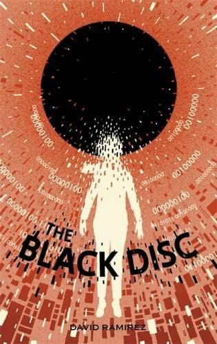
Black Disc
David Ramirez

Black Disc
David Ramirez

Childhood in Western Europe 1900-1960
David Kerr

Childhood in Western Europe 1900-1960
David Kerr

War and World Economy Reader
David Goldfischer

Secret Life of Football
David Triesman

Death Comes to Vicenza
David Dickinson

Homeland Security
Neal A. (Allen) Pollard

It's All True
David Freeman

Grain Brain
David Perlmutter
The devastating truth about the effects of wheat, sugar, and carbs on the brain, with a 4-week plan to achieve optimum health.

Emergency and Intractable Headache
David W. Dodick

Barry Island Through Time
David Ings
The popular south wales seaside resort of barry island has a long and distinctive history.

Cybercrime
David S. Wall

Jack Frost Sticker Book 1 Jack Frost Sticker Book 1
David Melling

Jack Frost Sticker Book 2 Jack Frost Sticker Book 2
David Melling

Horned Dinosaurs
David West

Jack Frost Flap Book 2 Jack Frost Flap Book 2
David Melling

Jack Frost TV Tie In
David Melling

Hereticks
David Nunemaker

Life and Works of Schubert
David Cairns

Securing the Virtual Data Center
David Anderson

Untitled David Matthews
David Matthews

Managing Performance and Capacity
David Collier-Brown

Sweet and Vicious
David Schickler

Fundamentals of Powertrain Calibration
David R. Rogers

Geographical Offender Profiling
David Canter
'crime hot-spots' and 'repeat victimisation' are eye-catching subjects in the wider study of where, and to a lesser extent when, individual criminals choose to commit their crimes.

Facebook Effect
David Kirkpatrick

Religious Sublime
David B. Morris

Kids of Appetite
David Arnold

Welsh Quaker Emigrants and Colonial Pennsylvania
Allen, Richard C.
Exploring the emigration to colonial pennsylvania of welsh members of the religious society of friends (quakers), this book appraises their experiences during a period of unparalleled change.

Geographical Offender Profiling
David Canter

Big Flavours and Rough Edges
David Eyre

Investigative Psychology of Serial Killing
David Canter
Serial killing drove the initial fascination with 'profiling' and was the focus of the earliest 'offender profiling' works.

Being Bailey Export/Airside/Ireland
David Bailey

Weaponized
David Guggenheim and

Being Bailey
David Bailey

Verdi
David Gilmour

Core AngularJS
David Geary
Angularjs has quickly emerged as the #1 open-source framework for building modern single-page apps with javascript and html5.

Real Peaky Blinders
David Meikle

Nicholls Untitled 4
David Nicholls

Journal Guide for Those Experiencing Loss
David Knapp

Dissident
David Herszenhorn

Exploring the Philosophy of Religion
Stewart, David

Quint
David Quint

Damrosch
David Damrosch

Claw Heart Mountain
David Oppegaard

To Vinland
David Mitchell

Damrosch
David Damrosch

At the Crossroads of Music and Social Justice
David A. McDonald

Substance Abuse and Addiction Research
Alan David Kaye

Education Debate
David Kirp
Similar books

Geocomputation with R
Robin Lovelace
Geocomputation with r is for people who want to analyze, visualize and model geographic data with open source software.

Geocomputation with R
Robin Lovelace
Geocomputation with r is for people who want to analyze, visualize and model geographic data with open source software.

Geospatial Data Science Quick Start Guide
Abdishakur Hassan

Understanding GIS
Smith, David

Connected Mobile Experiences and Location Based Services
Darryl Sladden

GEOValue
Jamie B. Kruse

Basic GIS Coordinates
Jan Van Sickle
Coordinates are integral building tools for gis, cartography, surveying and are vital to the many applications we use today such as smart phones, car navigation systems and driverless cars.

Geocomputation
Robert J. Abrahart
A revision of openshaw and abrahart's seminal work, geocomputation, second edition retains influences of its originators while also providing updated, state-of-the-art information on changes in the computational environment.

New Lines
Matthew W. Wilson

Progress in Cartography
Georg Gartner

Applied Geoinformatics for Sustainable Integrated Land and Water Resources Management in the Brahmaputra River Basin
Nayan Sharma
The central theme of this book is focused on the analyses and the results which emerged from the international research project brahmatwinn sponsored by european commission (ec) and conducted during 2006 2009.

Advances in Spatial Data Handling and Analysis
Francis Harvey
This book contains a selection of papers from the 16th international symposium on spatial data handling (sdh), the premier long-running forum in geographical information science.

GIS Tutorial for Python Scripting
Allen, David W.
Gis tutorial for python scripting uses practical examples, exercises, and assignments to help students develop proficiency using python(r) in arcgis(r) gis tutorial for python builds upon previously acquired gis skills and takes them to the next .

Advances in Spatial Data Handling and GIS
Anthony G. O. Yeh

Di li xin xi yuan shu ju fu wu jie kou gui fan
Guo jia ce hui di li xin xi ju (China)

Di zhi xin xi xi tong
Anbo Li

GIS Tutorial 2
Allen, David W.

Introducing Geographic Information Systems with ArcGIS
Michael D. Kennedy

Geo-Information
Mathias Lemmens
Geomatics, the handling and processing of information and data about the earth, is one geoscience discipline that has seen major changes in the last decade, as mapping and observation systems become ever more sensitive and sophisticated.

Introduction to Geospatial Technologies
Bradley Shellito

Headway in Spatial Data Handling
Anne Ruas
The international symposium on spatial data handling is the premier research forum for geographic information science.

National Geographic Traveler
Damien Simonis

Geoinformatics 2007.
Society of Photo-optical Instrumentation Engineers

Uncertainty in Remote Sensing and GIS
Giles M. Foody
Remote sensing and geographical information science (gis) have advanced considerably in recent years.

Geographic Hypermedia
Emmanuel Stefanakis
The integration of the web and multimedia technologies with geographical information systems (gis) has recently lead to the development of new forms of multimedia geo-representations.

Ji chu di li xin xi xi tong
Wei Zhou

Geoinformation und geotechnologien
Schäfer, Dirk Dr. rer. nat

Report of Inter-Ministerial Committee on Nation-wide GIS/Essential Maps Programme
Nigeria. Inter-Ministerial Committee on Nation-wide GIS/Essential Maps Programme

From Botswana to the Bering Sea
Thomas Y. Canby

